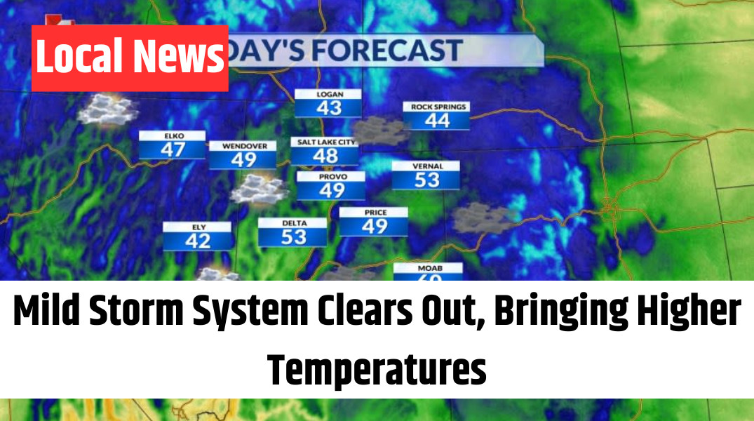
SALT LAKE CITY – Happy Thursday, Utah! The Spring Equinox officially arrived early this morning at 3:01 a.m., marking the seasonal shift. While the day started with plenty of clouds and cool temperatures, conditions were still a bit milder compared to Wednesday’s chilly morning.
A weak storm system passing north of the state has brought extra cloud cover and a few isolated snow showers in the mountains. There’s a small chance that some valleys could see a stray flurry or a brief sprinkle later today, but most areas will likely stay dry.
High pressure is set to make a short-lived return on Friday, though increasing clouds throughout the day will signal the approach of our next weather system. By Friday night into Saturday, another round of precipitation is expected, mainly impacting northern Utah.
Current forecasts suggest this will be a rain event for valley locations, while higher elevations will see fresh snowfall. Valley areas could receive between 0.10 and 0.25 inches of rain, with mountain snowfall totals ranging from 2 to 6 inches. However, this system is not expected to be as strong as recent storm events.
Looking ahead, drier conditions will take over on Sunday with abundant sunshine returning. By next week, a strengthening high-pressure system will bring significant warming. Temperatures in southern Utah could reach the upper 80s, while the Wasatch Front is likely to see highs in the low to mid-70s.
Stay tuned for further updates on our evolving forecast as we track these changing conditions.