
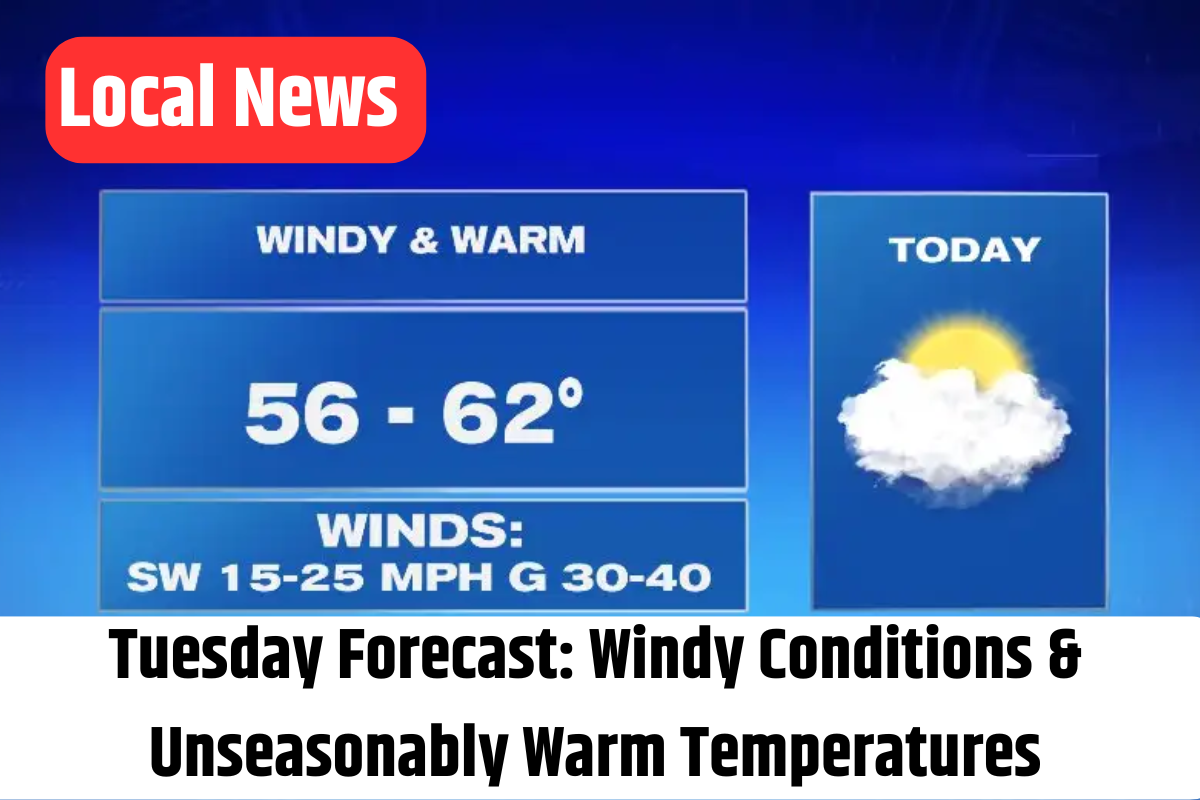
Good morning, Utah! Today’s weather is as dynamic as it is warm. Expect blustery conditions with gusts from the south reaching 25–35 mph, keeping things lively across the state.
A Warm Start:
Northern Utah will be mostly cloaked in clouds, while southern regions will enjoy a blend of sun and cloud cover. Temperatures are set to soar, riding about 20–25 degrees above the usual readings. Along the Wasatch Front, you can expect highs in the mid to upper 60s, and southwestern Utah will see temperatures climbing into the low 70s. To put things in perspective, Salt Lake City’s record high for a Tuesday afternoon is 60°F—a benchmark that was surpassed early this morning at 3 a.m., and St. George’s record stands at 73°F!
Overnight Outlook:

As night falls, a thick layer of clouds will continue to roll over the state. The gusty southern winds will persist, ensuring that the overnight temperatures remain significantly milder than usual. Most areas will see temperatures dip only into the 40s by early Wednesday morning.
A Shift on the Horizon:
Starting Wednesday, the dominant high pressure begins to relent as a new system approaches. This change will primarily impact northern Utah, where a narrow band of valley rain and mountain snow showers is expected north of I-80. Although temperatures will cool slightly, they’ll still remain well above average—with highs in the 50s and overnight lows settling in the 30s to 40s. Precipitation looks light, with valley rainfall accumulating to around 0.25″ and mountain areas possibly receiving a few inches of snow.
Looking Ahead to the Weekend:
Thursday should provide a short respite from precipitation across most of Utah. However, a stronger system is forecasted to move in by the end of the week. This system will bring a cold front along with additional moisture, leading to a sharp drop in temperatures. By Friday afternoon, residents in north and central Utah may see valley snow showers, with isolated showers possible in southwest Utah by Friday evening.

Stay tuned for ongoing updates from 4Warn Weather—whether on-air or online, we’re here to keep you informed. Enjoy your day, and remember, we are Good4Utah!
Key Takeaways:
- Strong southwest winds in effect
- Wind Advisory remains for Tooele & Rush Valleys
- Record-breaking temperatures earlier today
- Overcast skies with pockets of sun
- A shift to unsettled weather beginning Wednesday
- Light valley rain and mountain snow showers
- A robust cold front and dropping temperatures for the weekend